
Archive Record
Images
Metadata
Collection |
Benson Historical Society Collection |
Catalog Number |
2006.007.16.1-2 |
Object Name |
Map |
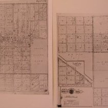
Scope & Content |
Photo copy of Plat map: “Baist’s Real Estate Atlas of Omaha”. Plate 29. Benson area- 52nd to 72nd, from south of Blondo to Pratt. Original copy property of Douglas County Historical Society. Map is undated but must be after annexation in 1917. |
Creator |
Baist's Real Estate Atlas |
Title |
2 photos of Benson area of Baist's Surveys of Omaha |